
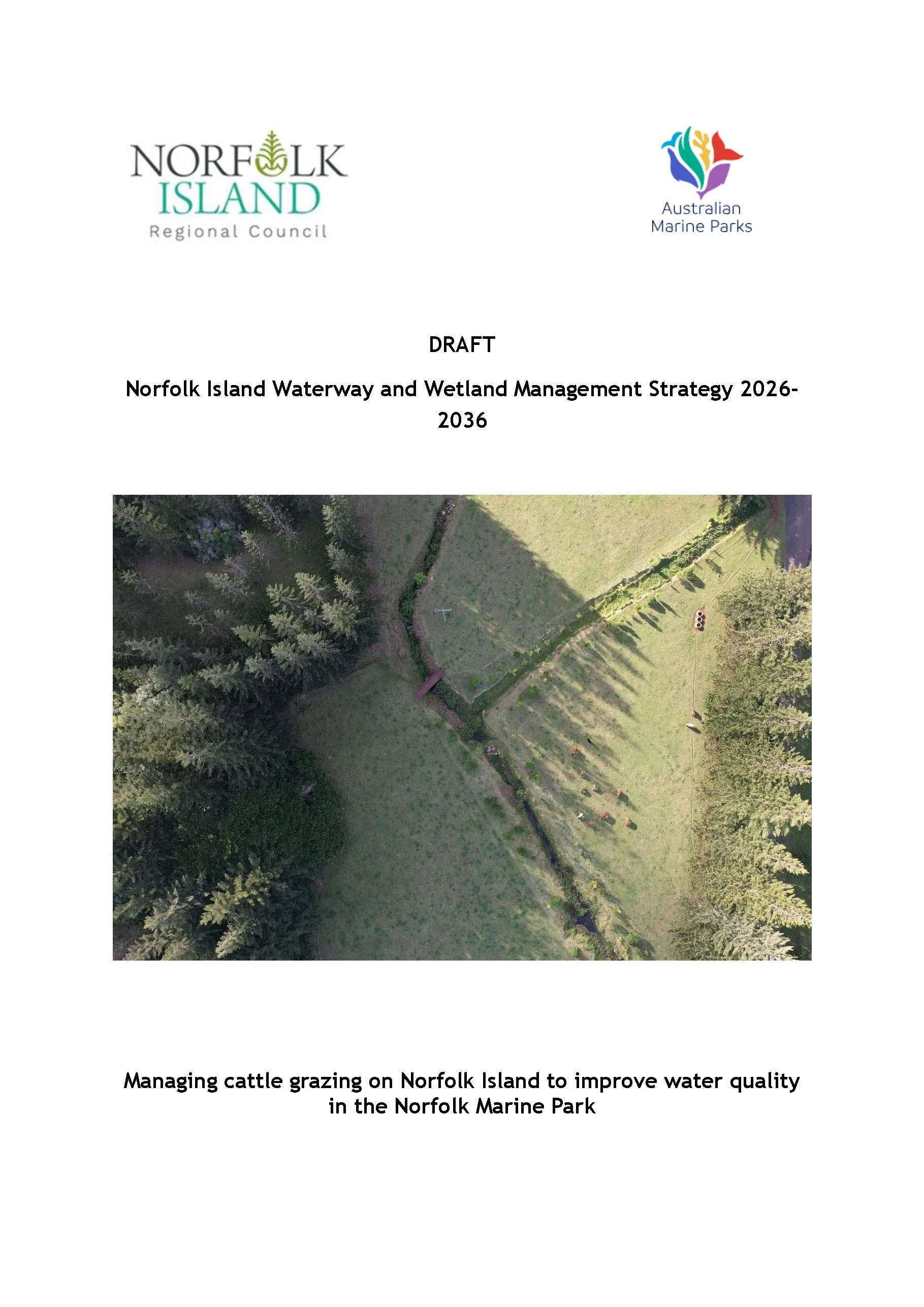
Click on the image to download the Waterway and Wetland Strategy
Why the Waterway and Wetland Strategy deserves a proper look
I know. Another strategy. Another public exhibition. Another request for community feedback. I can almost hear the collective groan from here. Which is why I thought I’d unpick this latest strategy and hopefully draw your attention to the good bits and the bits that I think still need work.
Norfolk Islanders are suffering from consultation fatigue, let’s not lie. We’ve had plans, strategies, policies, surveys, public exhibitions, meetings, workshops, committees and documents coming at us from every direction. Most people are busy. Most are tired. And most are not going to sit down and read a long technical document unless they absolutely have to; however, this one is worth understanding.
The Draft Norfolk Island Waterway and Wetland Management Strategy 2026–2036 is now on public exhibition, with submissions open until 11 August 2026. It is intended to guide waterway and wetland management on Norfolk Island for the next decade. It may also help unlock and direct significant public funding.
I want to say at the outset that this is a good and useful document. It brings together a great deal of information about Norfolk Island’s waterways, wetlands, grazing pressures, acid sulfate soils, erosion, private-land incentives and reef-connected catchments. That work should be acknowledged.
But because it is a good starting point, it is worth strengthening. A ten-year strategy needs to do more than point in the right direction. It needs enough nuts and bolts to guide the Norfolk Island Regional Council (NIRC), landholders and the community through implementation, so the big decisions are not left to be worked out later, once funding has been secured and works are already underway.
In other words, it is about a whole-of-island system, which is why we need to get it right.
What is actually in the strategy?
At a high level, the strategy sets out how Norfolk Island’s waterways and wetlands should be managed over the next ten years. It identifies the main threats to waterways and wetlands, including unrestricted cattle grazing, erosion, road and urban runoff, invasive species, acid sulfate soils, climate change and wastewater issues. It ranks waterways and wetlands across the island into priority categories – Very High, High, Medium and Low – based on things like ecological value, cultural value, economic importance, acid sulfate soil risk and urgency of intervention.
The highest priority catchments include Watermill Creek, Town Creek, Cascade Creek, Rocky Point Creek and the Mission Road area. Watermill and Town Creeks are considered especially important because they discharge into the Emily and Slaughter Bay lagoonal reef system.
The strategy also sets out proposed works and actions. These include fencing, revegetation, weed control, erosion management, stock exclusion, alternative watering points, wetland protection, stormwater works, acid sulfate soil management, pest animal control, freshwater species monitoring and community engagement. The strategy also proposes support for private landholders through voluntary incentive schemes. That means helping people do works on their own land where those works can improve waterway health and water quality.
It also includes a Monitoring, Evaluation and Reporting framework – usually referred to as a MER – which is supposed to track whether the strategy is working.
So, yes, while it is a significant document, the basic idea is simple enough: we need to improve the way we manage the land so we can improve the condition of our waterways, wetlands and downstream marine environment. And this is something I strongly support.
This is not only about Council land
The strategy is not only about public reserves or Council-managed land, it also applies to private land. If you have a block of land that stretches down to a watercourse, drainage line, creek, wetland or damp area, this strategy may be relevant to you, even if that watercourse only runs after rain and is not what most people would think of as a ‘creek’. Water does not care about fence lines. It runs downhill. It carries soil, nutrients, faecal contamination, chemicals and whatever else is on the land with it. That can be in slow time, or all at once after heavy rain, which is why a whole-of-island approach matters.
From the ridge to the reef
One of the phrases I keep using is that we need an integrated catchment management. It sounds bureaucratic, but it is actually a very practical idea. Integrated catchment management means we stop treating each issue as if it sits in its own little box.
Integrated catchment management means we stop pretending these issues sit neatly in their own little boxes. Cattle, stormwater, septic systems, groundwater, wetlands, road runoff, public land, private land and reef health all overlap. Water moves through the lot, picking things up as it goes, and eventually some of it reaches the bays. If we want to protect the reef, we need to understand the whole pathway – not just keep managing each piece as if it has nothing to do with the next one.
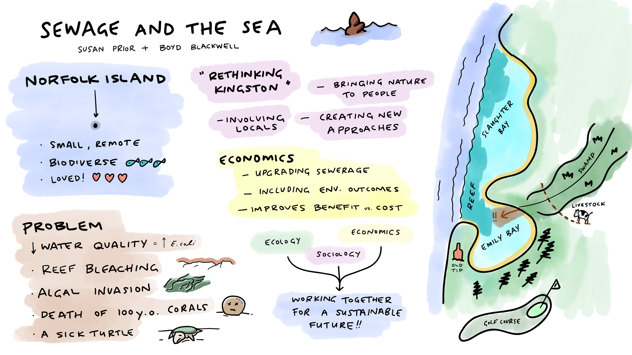
Infographic by Dr Tom Rayner, ANZSEE 2024, for a paper presented by Dr Boyd Blackwell and Susan Prior
What is a whole-of-island approach?
A whole-of-island approach means we recognise that Norfolk is small, connected and complicated.
We do not have the luxury of pretending that water quality can be fixed by one department, one landholder, one grant program, one committee or one document. Too often on Norfolk, each part of the system is managed separately, even though the water itself is moving through all of it. Council, Parks Australia, Australian Marine Parks, DITRDCA, private landholders, graziers, KAVHA, tourism operators, researchers and the wider community all hold different pieces of the same puzzle. If this strategy is going to work, those pieces need to be brought together.
We also need to recognise that different parts of the island carry different risks. Acid sulfate soils are an issue in some catchments, while others carry more water, drain more directly towards the reef, sit mostly on private land, or fall within public land and culturally sensitive landscapes. Some areas are scenic and highly visible. Others are awkward, steep, hard to access, or only show themselves as waterways when heavy rain starts moving through the system. A whole-of-island approach does not mean doing the same thing everywhere. It means understanding those differences, and planning for how they connect.
The reef sits at the bottom of the catchment
The part of the strategy I keep coming back to is the connection between land and reef.
The draft strategy recognises that Watermill Creek and Town Creek discharge into the Emily and Slaughter Bay lagoonal reef system. It also recognises that degraded water quality – including nutrients, faecal contamination, sediment and other pollutants moving through the catchment – is affecting coral reef health.
That lines up with what coral-health researchers have been warning about for several years. Their final results from the most recent visit have not yet been published, so I am not treating those as final data here. But recent public reporting has again raised concern about continuing coral disease, reef decline and the combined pressures of water quality, nutrients, sediment, wastewater, cattle impacts and other stressors.
The reef does not begin at the water’s edge. It is influenced by what happens on the land adjoining it. Rainfall runs over roads, paddocks, gardens, drains, grazed areas, wetland edges and developed land. It moves through creeks and groundwater. Eventually, some of it reaches the bays. So when we talk about reef health, we need to talk about what is happening on land as well.
That is not about blaming one group or one activity. Cattle are part of the picture, but so are septic systems, stormwater, herbicides, pesticides, climate change, population growth and the way water moves through the catchment after heavy rain. The point is not to single out one pressure and pretend the others don’t exist. We need to join the dots.
I want to be very clear, so it is worth repeating: I support the intent of this strategy. But I think it needs strengthening. A great deal can happen in ten years, and this strategy will still need to be fit for purpose in 2036. Norfolk Island needs a coordinated approach to waterway and wetland management. We need better protection of riparian areas, better management of cattle access to waterways and wetlands, and a reduction in erosion and sediment runoff. We need to support private landholders who are willing to fence, restore and manage waterways on their land. And we need to protect acid sulfate soils from disturbance, drying and poor water management.
For this document to guide the next ten years of work, it must be clear, measurable, practical and accountable.
The questions I asked
As a member of the Council’s Environment and Sustainability Advisory Committee (ESAC), I prepared a list of questions about the draft strategy before it went to public exhibition. Up to the time of writing this post, those questions have not been answered. I had hoped they would be made available as part of the public exhibition material, because I think they would help the community understand what still needs to be clarified. I am raising the issues here from my own perspective. These are not ‘gotcha’ questions, and they are certainly not an attempt to derail the strategy. They are the kinds of questions I think we should be asking before a ten-year strategy is adopted.
How will we know if the reef is benefiting?
This is probably my biggest question.
If the strategy says it is about improving water quality in the Norfolk Marine Park, how will we measure that? It is not enough to count how many metres of fencing go up or how many plants go in the ground. While these are important, the final test is whether the works reduce sediment, nutrients, faecal contamination and other pressures moving through the catchment and into the bays.
That does not necessarily mean the Council has to do every piece of monitoring itself. The Council may not be the body doing all of that monitoring. Some of it may sit with Parks Australia, Australian Marine Parks, CSIRO, universities or other agencies. That is fine. But if that is the model, the strategy needs to say how all those pieces will be brought together.
One of the problems we keep running into on Norfolk is siloed management. One body looks after one piece, another body looks after another piece, and somehow the whole picture still does not quite come together. For this strategy to work, the monitoring needs to be joined up. If Council is responsible for catchment works, but another agency or research group is monitoring water quality or reef health, there needs to be a clear mechanism for bringing those results together.
That means monitoring needs to include freshwater sites, outflow points and receiving marine sites where relevant. It also needs to include rainfall-event monitoring, not just routine sampling, because the worst pulses are likely to happen after heavy rain. A dry year may make the water look better even if nothing has changed. A wet year may make things look worse even if works are helping. We need a monitoring program that can tell the difference. And we need the results reported back to the community in a way people can understand.
The view across Kingston Common and Old Military Barracks from Queen Elizabeth’s Lookout
What baseline are we using?
If we want to know whether the strategy is working, we also need to know the starting point.
What baseline will be used? The CSIRO / NIWRA water-quality work? Earlier Council data? Beachwatch? New monitoring? A combination? Without a clear baseline, it will be hard to say whether water quality is improving, getting worse or just changing with rainfall.
What happens if the results are poor?
Monitoring will, of course, produce reports. But the point of monitoring should be to guide decisions, not simply create another set of documents.
If nutrients, turbidity, faecal contamination or sediment loads remain high, what changes? Does Council reassess the works, increase buffer widths, investigate septic systems, look again at stormwater, commission source tracking, or change priorities?
A good strategy needs a feedback loop: monitor, compare, investigate, adjust, report. Without that loop, monitoring becomes record-keeping rather than management.
Wastewater, septic systems, and cattle all need to be part of the same conversation
The draft strategy recognises that poorly maintained or ineffective septic systems have contributed to nutrient-contaminated groundwater in some populated areas. It also recognises that sewerage expansion depends on funding. But I still think wastewater and septic systems need to be joined up more clearly with the waterway and reef-health work.
Likewise, if we are serious about improving water quality in the Norfolk Marine Park, we cannot treat cattle, stormwater, septic systems, groundwater and reef health as separate conversations. One obvious example is the recent Draft Norfolk Island Public Land Grazing Management Strategy. That strategy and the Waterway and Wetland Strategy should have sat hand in glove, treated as two connected parts of the same broader approach rather presented independently of one another.
We need to know how this strategy connects with any wastewater treatment plant planning, the Water Assurance Scheme, septic-system management, groundwater contamination and priority sewerage connections.
We also need to know how Council will distinguish different sources of contamination, including those identified in the 2024 CSIRO water-quality work. Is it human? Cattle? Birds? Other livestock? A mix of sources?
If we do not know where the pollution is coming from, we risk spending money on one pressure while another continues, and making decisions based on assumption rather than evidence.
Acid sulfate soils need careful handling
The draft strategy recognises acid sulfate soils as a risk. That is good. But this is one of those areas where recognition is not enough.
If acid sulfate soils are disturbed or allowed to dry, they can release acid and metals into waterways. The draft strategy recognises that disturbance, including cattle pugging, can affect water quality, Emily and Slaughter Bays, human and animal health, and KAVHA infrastructure; therefore, the final strategy needs clear operational safeguards.
Where acid sulfate soils are mapped or suspected, works plans should include clear protocols. That includes fencing, drainage, stormwater, excavation, wetland works, road works and cattle access.
This is an area where poorly planned action could make things much worse.
What are the expectations around cattle and buffers?

Fencing waterways in Kingston is meaningless when the wetland area shrinks and expands according to how much rainfall we have had
The strategy recognises that unrestricted stock access can damage waterways and wetlands through soil pugging, erosion, sediment and nutrient runoff, weed invasion, reduced native regeneration and acid sulfate soil disturbance. It also recognises that public land grazing has cultural, scenic and economic value for some people.
Both of these things can be true.
But in very high priority catchments and high-risk public land areas, the final strategy needs to be clear about the minimum expectations. Will cattle be excluded from waterways, wetlands, dams, acid sulfate soil areas, steep slopes and erosion-prone areas? Or will some high-risk areas remain open to negotiated partial access?
What minimum riparian buffer width is Council aiming for? The draft notes that some existing fencing setbacks are well below recommended distances of 20 metres or more. If narrower buffers are used because of landholder constraints, that should be acknowledged honestly.
Kingston Common needs particular care because the wetland edge shifts with rainfall. A buffer measured from a dry-weather waterline may not protect the wetland during wet periods.
What if voluntary incentives are not enough?
The strategy is based on offering voluntary incentives to landholders to undertake waterway and wetland improvements on their properties. That is a good place to start, and I support it. But the final strategy also needs to explain what happens if voluntary uptake is not enough, particularly in the highest-risk catchments.
If a catchment drains towards Emily or Slaughter Bay, and if it has been identified as very high priority, what happens if key landholders are unable or unwilling to participate? What happens if they are willing, but the available funding is not enough to make the work practical? Some of Norfolk’s waterways sit at the bottom of steep, awkward valleys that are hard to access at the best of times. In some places, landholders may need more than a contribution towards fencing or plants. They may need practical help on the ground.
That does not mean the strategy needs to become heavy-handed. But it does need a clear pathway.
At what point does Council review whether voluntary incentives are working or whether priorities need to be adjusted? At what point is additional support considered? And at what point should other tools be considered for high-risk areas where waterway and reef protection cannot be achieved through voluntary uptake alone?
These are important questions that should be asked now, so the strategy can make the best use of limited funding and avoid stalling in the catchments where action is most needed.
Maintenance is where strategies often fail
Planting is not restoration unless someone and maintains it. Likewise, fencing is not protection unless it is kept in good repair.
The first burst of funding is often the easier part: put up the fence, plant the plants, take the photo, write the report. The harder part is what happens over the next five to ten years – weed control, replacement planting, fence repairs, watering-point maintenance, landholder follow-up, monitoring, reporting, and adjusting the program if it is not working.
The final strategy needs a clear maintenance plan and a staged implementation table. I understand that grant funding is often provided in three-year blocks because that is how government funding cycles tend to work. But a ten-year strategy still needs to look beyond the first funding round.
The public should be able to see what is expected to happen in the early years, what might follow in years 3–5, and what longer-term work is likely to be needed in years 6–10. We should be able to see who is responsible, what is funded, what is not yet funded, what the priorities are, and how the work will be maintained after the initial grant-funded activity is complete.
The review process should be built in from the start, rather than left until the end of the first funding period when everyone is suddenly trying to work out what worked, what did not, and what should go into the next grant application.
Without that, the strategy risks becoming a list of good ideas rather than a functioning catchment program.
The public needs simple reporting
If people (and ‘people’ definitely includes me!) are being asked to support change, they need to see what is happening; to that end I would like to see an annual plain-English catchment–reef scorecard. This would not be another dense technical report that only a handful of people will read, but instead something simple. Something that shows:
what work was done;
where it was done;
what money was spent;
what monitoring showed;
whether water quality improved;
what maintenance happened;
what problems were found; and
what will happen next.
People need to see the reward for effort. If landholders are being asked to change practices, graziers are being asked to adapt, public money is being spent and the community is being asked to care, then the community deserves to know whether the work is making a difference or not. Don’t you agree?
What I am saying in my own submission
I will be making a personal submission on the draft strategy. I will support its intent, because I really do want it to succeed, but I will also be asking Council to strengthen the final version before adoption. In particular, I will be asking for:
a clearer consultation record;
a stronger integrated catchment management framework;
a genuine whole-of-island approach;
stronger catchment-to-reef monitoring;
rainfall-event sampling;
clear baselines, indicators, triggers and decision points;
better integration of wastewater, septic systems and groundwater;
operational safeguards for acid sulfate soils;
clearer expectations around cattle exclusion and riparian buffers;
a pathway if voluntary incentives are not enough in high-risk catchments;
staged implementation, funding and maintenance plans;
clearer governance and accountability;
annual plain-English public reporting; and
formal review after the first year and again at the end of the initial three-year funding period.
None of this is about opposing the strategy. Instead, it is all about making it strong enough to work on a practical level.
Please have a say, even if you only have one point to make
People are tired, and fair enough. Public exhibitions can feel like homework, and a lot of people will look at a document like this and decide it is not for them.
But if you own land or lease land, graze cattle, manage a property, live near a watercourse, care about Emily Bay, swim at Slaughter, work in tourism, care about Kingston, worry about septic systems, notice runoff after rain, or simply want Norfolk’s reef to have a future, this strategy is relevant to you.
It doesn’t have to be a technical submission. You can ask one question. You can say what you support, or not, or what worries you. You can ask how the work will be funded, maintained, monitored and reported. You can ask how we will know whether the reef is actually benefiting.
For me, the point is simple: Norfolk Island needs integrated catchment management, not more disconnected projects. We need a whole-of-island approach, not another silo. The reef sits at the end of the pipe and unfortunately what we do on land does not stay on land. Which is why this strategy deserves attention now, while it can still be improved.
Submissions close on 11 August.
Rain is precious on Norfolk. All the more reason to manage where it goes, what it picks up, and what it carries to the reef